

GLONASS + Beidou is largely a strategic project
During President Xi Jinping's visit to Moscow, Russia and China agreed on a new stage of cooperation in the field of satellite navigation. In order to ensure the compatibility and complementarity of the Russian GLONASS system and the Chinese Beidou, as well as to promote joint projects on the use of navigation technologies, it was decided to create a bilateral subcommittee. Alexander Boreyko, CEO of IntelTech, told MK about the prospects for this interaction.
“Technologies and systems of satellite navigation are widely used in many areas,” says Alexander Boreiko. — These are transport, energy, communications, civil aviation, and many other industries, both traditional and high-tech. In agriculture, for example, high-precision navigation is used to control agricultural machinery for tillage and harvesting. With might and main, drones controlled using satellite navigation data are used to monitor the condition of crops.
Navigation receivers are also an element of all modern gadgets, switching systems, control systems. Therefore, cooperation with the Chinese side on the joint use of navigation systems opens up new opportunities. This also applies to improving the accuracy of navigation and the reliability of all systems.
Satellite navigation technologies, according to the expert, form the basis of national security and technological sovereignty of both states.
< p>— The use of two systems is the minimization of certain technological risks. And the second moment. When we measure the coordinates and velocity vector of an object, determine the time, the accuracy and reliability of such calculations increase. In addition, interaction with our strategic partner, equal exchange of experience and knowledge in new areas of application, in new technologies is always useful to accelerate advanced developments and ensure their implementation.
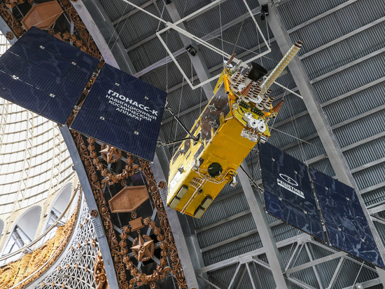
The regular constellation of the Russian GLONASS system includes 24 satellites. They move above the Earth's surface in three orbital planes at an altitude of 19.1 thousand kilometers. Two types of navigation signals are used: open with normal accuracy and protected with increased accuracy. The latter are intended for authorized users, such as the Russian Armed Forces.
The Chinese navigation system «Beidou» is named after the constellation «Big Dipper» (in the Celestial Empire it is «Northern Bucket»). The orbital constellation includes 49 vehicles.
— I propose not to compare the number of satellites. China just has a different orbital constellation configuration. GLONASS and Beidou are technically comparable. Both systems are actively developed. At the same time, sharing provides the necessary synergy that can be obtained when you interact with an equal partner interested in the same cooperation.
The expert notes that there is no question that this will be some kind of unified system.
We have our own system, China has its own. An agreement was reached on cooperation and mechanisms for the joint use of navigation systems. In many ways, this is a strategic project.