Republic intends to seriously develop the space sphere
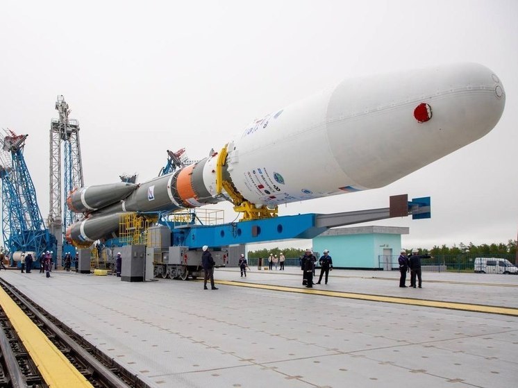
The first Chechen satellite Akhmat-1 was launched from the Vostochny Cosmodrome as an associated payload on a Soyuz-2.1b carrier rocket. The main cargo was the Meteor-M hydrometeorological satellite No. 2-3.
 Photo: Sergey Emelyanov
«Akhmat-1» – one of 40 small satellites (cubesats) sent into space. It was developed by specialists from the Chechen State University and the South-Western State University (Kursk) as part of the «Planet Duty Officer» program. According to experts, the device weighing 2.5 kg is equipped with a module for receiving messages of automatic dependent surveillance-broadcasting (AZN-B) and is designed to monitor the movement of aircraft within 1,500 km. For the first time, the satellite will test the technology of transmitting data from the aircraft to the control room.
According to the rector of the Southwestern State University, Sergei Yemelyanov, aircraft pilots, as well as air traffic controllers on Earth, will be able to observe the movement of the aircraft with great accuracy and receive real-time location data.
According to the telegram channel of Ramzan Kadyrov, the development of this satellite was started by the CSU team last year. In addition to the observation-broadcasting module, a radio transmitter is installed on it, which will broadcast greeting audio recordings from students.
 Photo: Sergey Emelyanov
⠀This year, another grant was received for the second satellite. Unlike «Akhmat-1» it will be retrofitted with a video camera and high-tech sensors for measuring the Earth's magnetic field. In addition, according to the telegram channel, work is underway to create a Mission Control Center based on ChSU. It will allow you to receive data from satellites directly.
As commented by the head of the Space Policy Institute Ivan Moiseev, judging by the description, the satellite of ChSU and SWSU is very similar to a relatively new type of satellites that form the AIS (Automatic Identification System) system, which helps cheaper and more accurate than terrestrial radio beacons to determine the location of aircraft, ships in the radio range and broadcast this information to the customer. Unlike heavy GPS or GLONASS satellites, this — more simplified and can be used in the interests of a particular customer.


